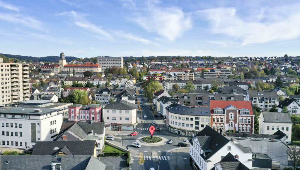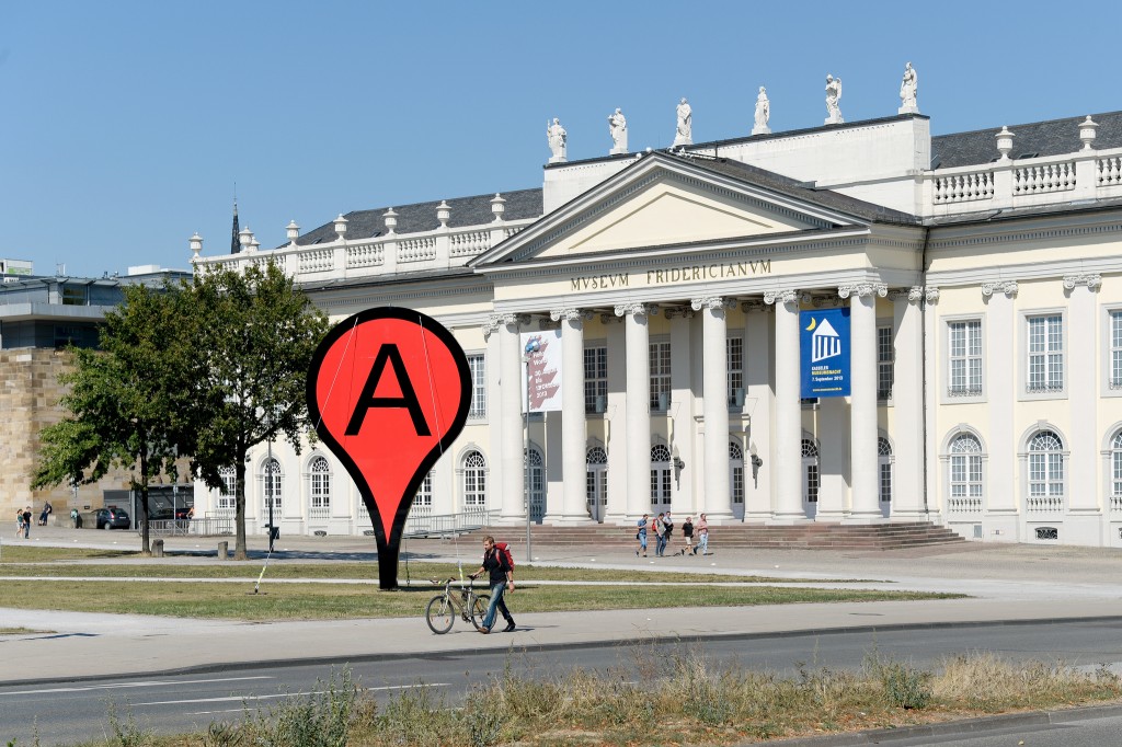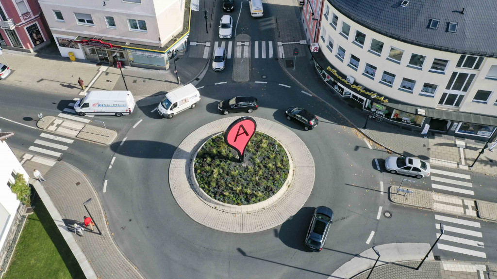
Map Arnsberg
Map, permanent installation in public marking the center of the city of Arnsberg, Germany. Dimensions: 600 x 340 x 25 cm, Material: steel, Year: 2019
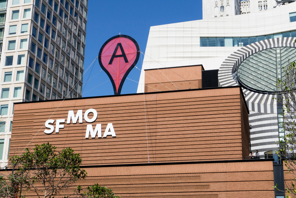
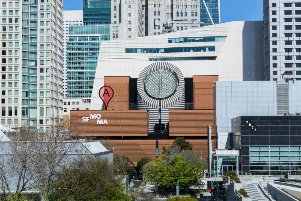
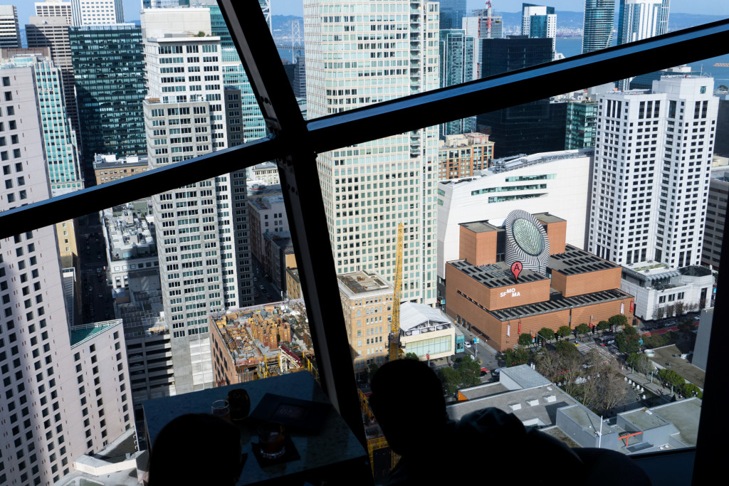
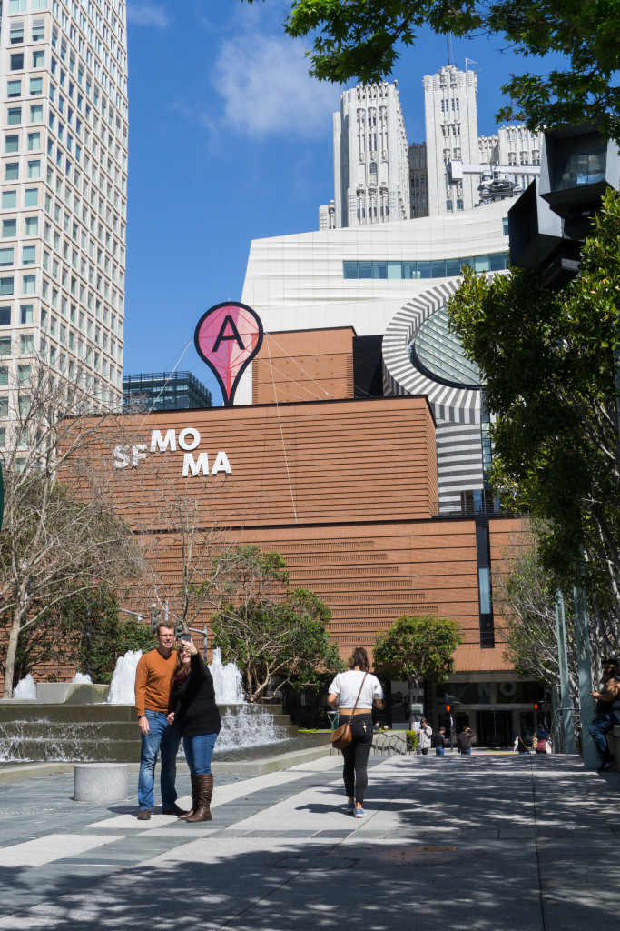
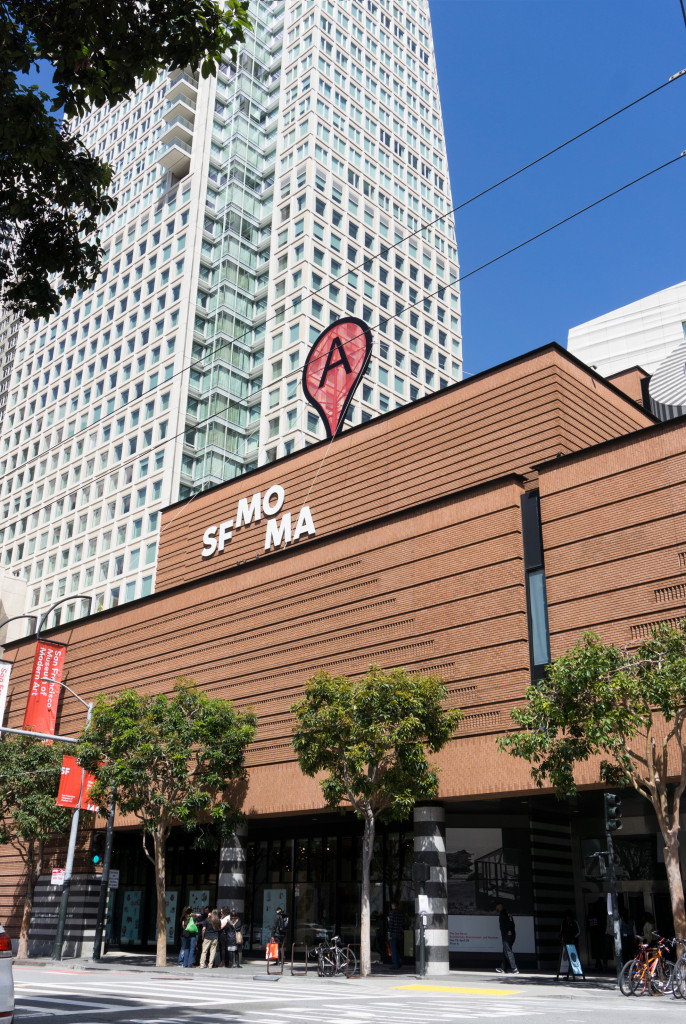
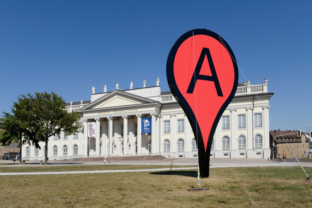
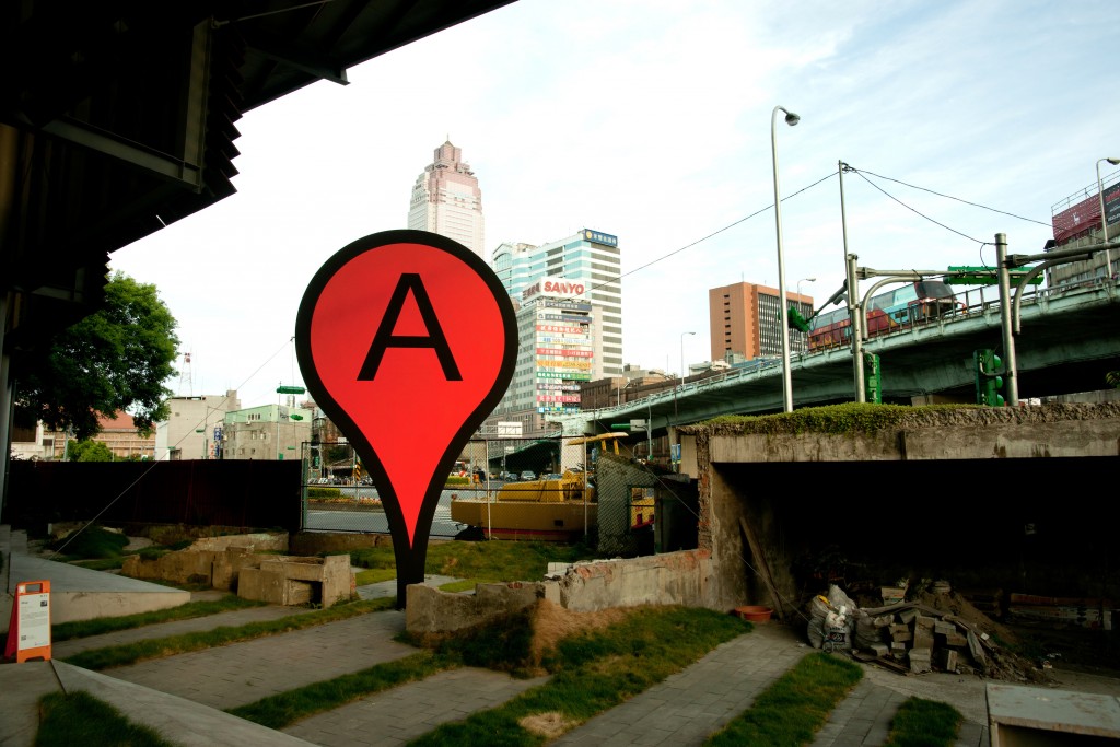
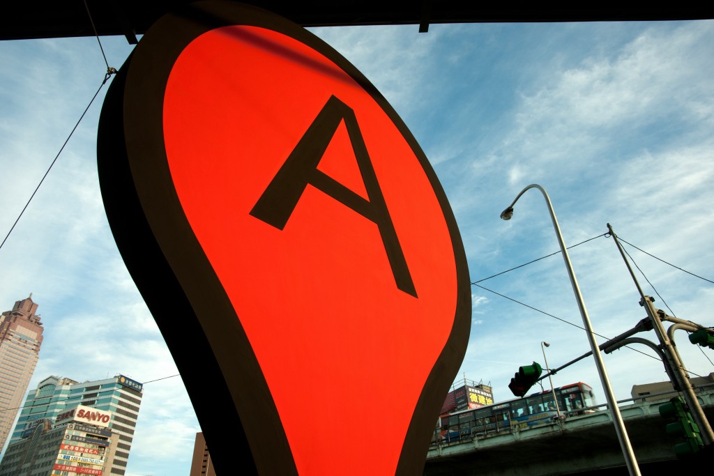
Map SFMOMA
Map is being installed on the roof of SFMOMA for the upcoming ‘snap+share’ show. I made the first iteration of this piece in 2006, more than a decade ago—an epoch in Internet time. It is fascinating to see how much the context and meaning of this piece have changed over the years. Thirteen years wouldn’t usually be a huge timespan for a work of art to age, but in this particular case the speed of developments mean Map now looks very different. It has already become a historical work.
In 2004, Google bought Where 2 Technologies, a company that had worked on the digital map service that became Google Maps a year later. It was still the mid-early days of the web. The Internet was not as present in society as it is today, but tech giants like Google were already taking shape.
It was part of my practice back then to make such translations, to take an object from a computer game or an icon from a web service and to transform it into a physical sculpture. What would happen if I turned this 15-pixel computer icon into a real thing and put it in the city? Is this the center of the city? These and other projects were an attempt to understand how this new world of computers, networks, and screens would affect society and physical space. They were a sign of what was to come.
Today the situation is very different. We have the famous oligarchy of Internet tech giants who are constantly squeezing more data and money from every bit of communication, movement, and interaction everyone produces worldwide. They have expanded into all kinds of markets in a never-ending run of disruption with little objection or regulation from government. Today, data extraction markets are deeply woven into a very physical fabric of everyday life in cities, business, homes, and personal communication. The dualism of digital versus analog has been obliterated; everything is deeply interconnected.
Of course, it is an honor to show Map in such a prominent location at the SFMOMA in downtown San Francisco. But in a way, it is also an irony of history that this piece from 2006 is ‘coming home’ today to the heart of Silicon Valley in an era dominated by full-blown surveillance capitalism data markets.
Aram Bartoll, 2019
Thanks to the whole team at SFMOMA making this possible!!
——————————————————————————
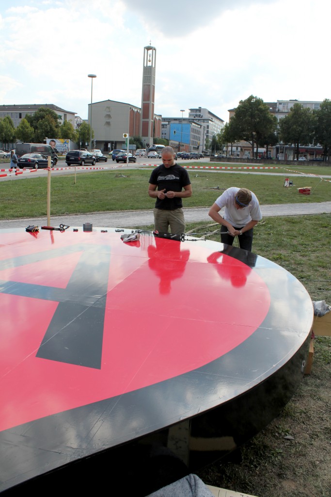
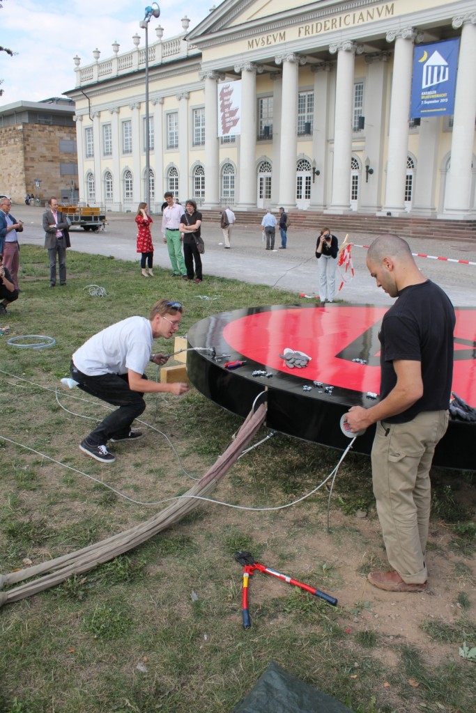
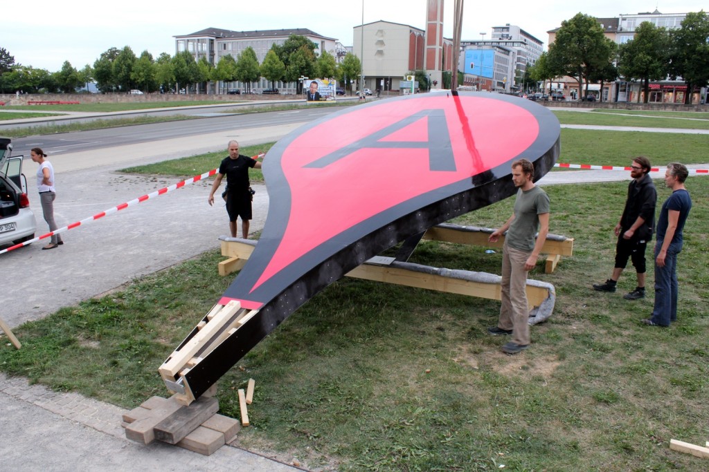
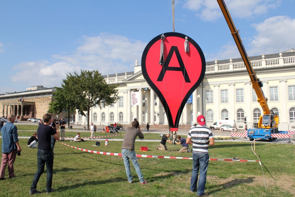
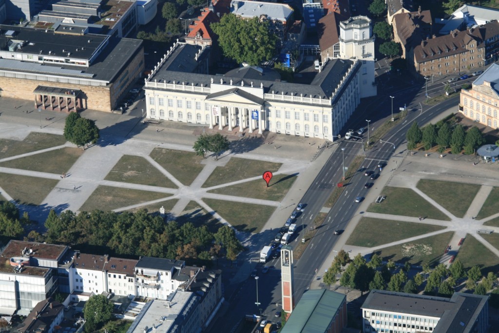
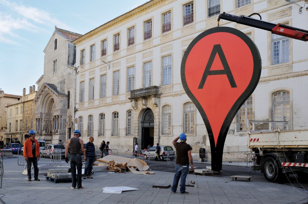
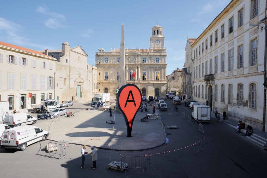
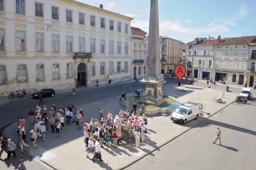
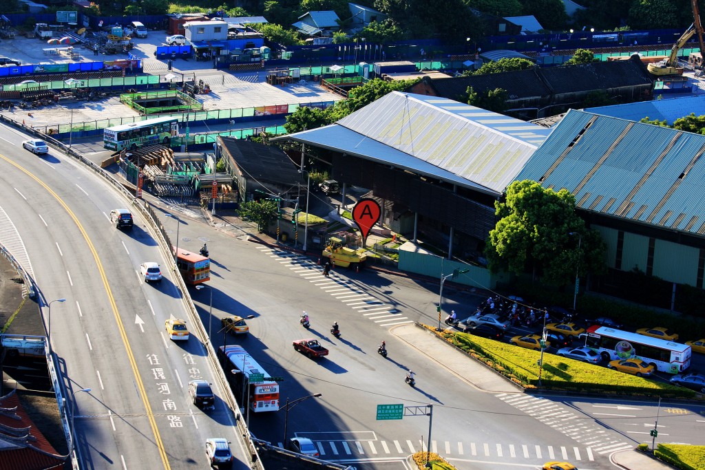
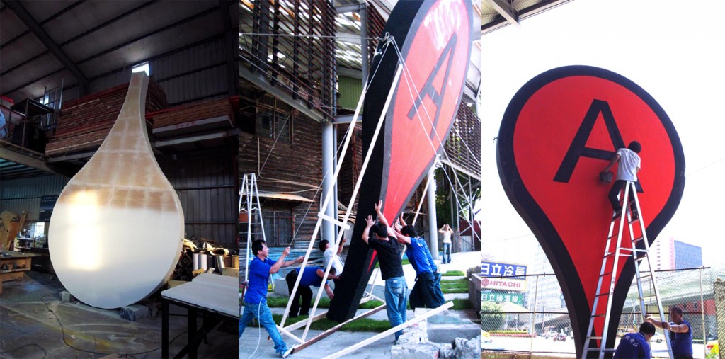
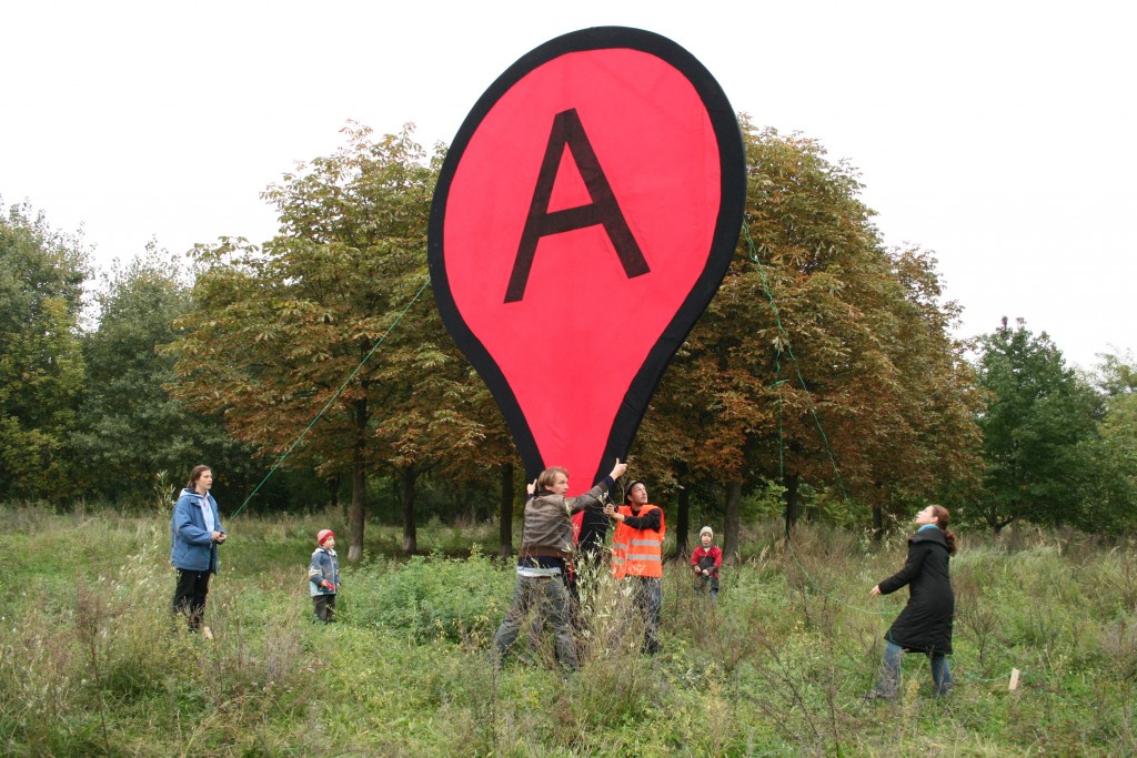
Map, 2013
wood board, wood beams, color, wire, screws, glue, nails
600×350×35 cm
The project ‘Map’ is a public space installation questioning the red map marker of the location based search engine Google Maps. “Find local businesses, view maps and get driving directions in Google Maps.” With a small graphic icon Google marks search results in the map interface. The design of the virtual map pin seems to be derived from a physical map needle. On one hand the marker and information speech bubble next to it cast a shadow on the digital map as if they were physical objects. When the map is switched to satellite mode it seems that they become part of the city. On the other hand it is a simple 20 px graphic icon which stays always at the same size on the computer screen. The size of the life size red marker in physical space corresponds to the size of a marker in the web interface in maximal zoom factor of the map. Where is the center of a city? In the city center series ‘Map’ is set up at the exact spot where Google Maps assumes to be the city center of the city. Transferred to physical space the map marker questions the relation of the digital information space to every day life public city space. The perception of the city is increasingly influenced by geolocation services.